Building date: 1840, Razed early September 1888 after fire.
Original use: Church
Editor's Note: For any known details for the following documentation, please refer to Karen Crandall's History Sheet in "Comments, Additional Information, References" section below.
Corner structures:
Mortar application and content:
Types and uses of stones:
Types and choice of windows:
Structures with similar masonry details:
Masons who worked on building:
Unique features:
Map views courtesy Google Maps. Address is Google Earth confirmed; 43°57'11.61"N 77°35'31.06"W.
Town of Mendon and Monroe County 1978 Highway Maps
Christian Church of Honeoye Falls history sheet. From the personal research of cobblestone historian Karen Crandall.
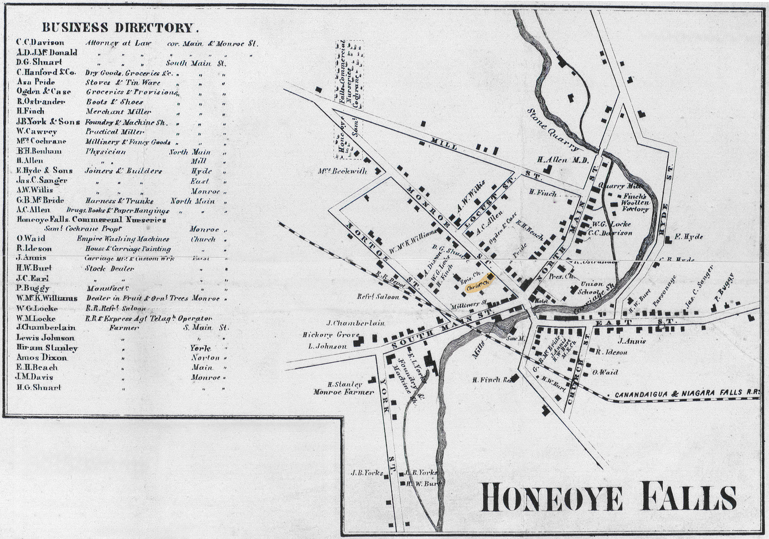 1858 Monroe County Map Men-17 Excerpt.jpg ¹ | 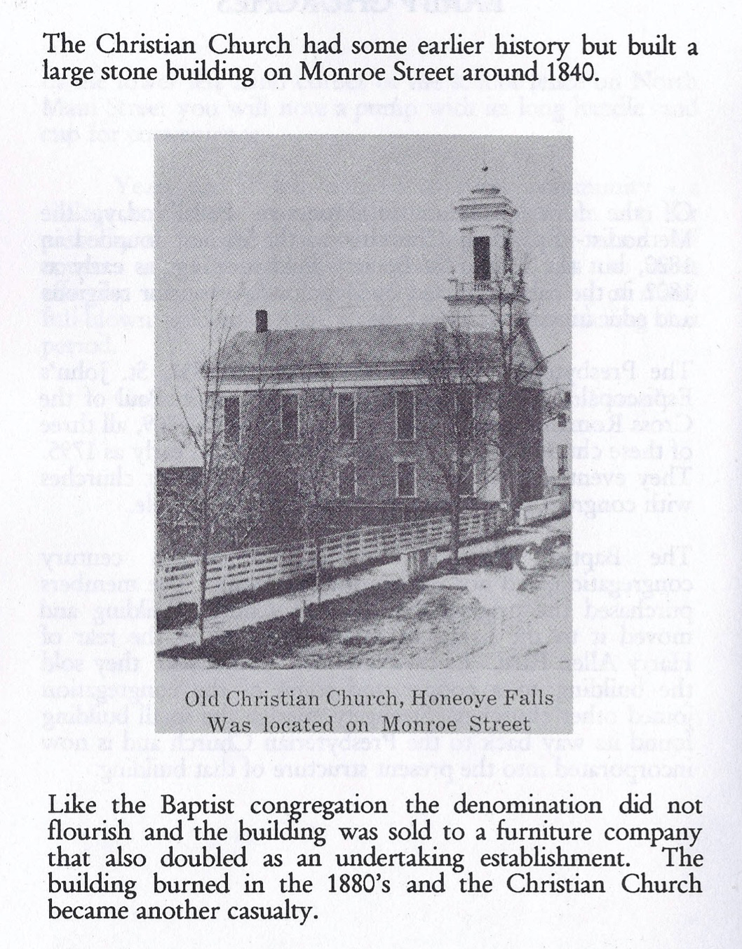 HF Christian Church pix + writeup.jpg ¹ |
¹ 1858 Monroe County Map Men-17 Excerpt courtesy Library of Congress.
² Imagery courtesy Karen Crandall.
